Euroacademia Conferences
 Europe Inside-Out: Europe and Europeanness Exposed to Plural Observers (9th Edition) April 24 - 25, 2020
 Identities and Identifications: Politicized Uses of Collective Identities (9th Edition) June 12 - 13, 2020
 8th Forum of Critical Studies: Asking Big Questions Again January 24 - 25, 2020
 Re-Inventing Eastern Europe (7th Edition) December 13 - 14, 2019
 The European Union and the Politicization of Europe (8th Edition) October 25 - 26, 2019
 Identities and Identifications: Politicized Uses of Collective Identities (8th Edition) June 28 - 29, 2019
 The European Union and the Politicization of Europe (7th Edition) January 25 - 26, 2019
 7th Forum of Critical Studies: Asking Big Questions Again November 23 - 24, 2018
 Europe Inside-Out: Europe and Europeanness Exposed to Plural Observers (8th Edition) September 28 - 30, 2018
 Identities and Identifications: Politicized Uses of Collective Identities (7th Edition) June 14 - 15, 2018
Uncovering Romania by Geography. A Study on How Geography in Romania Cultivated Lands and Romanians
-
-

-
Presentation speakers
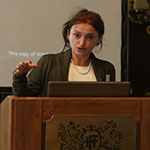
- Cosmina Paul, National School of Political and Administrative Studies, Bucharest, Romania
- Download presentation
Abstract:
Geography, far from an objective, dry and value-free science, invented new worlds as it invented Eastern Europe. Imperialist in its nature, geography became the mistress of nationalism in the 19th century, when national geographies empowered state building and nation identity. Romanian geography, as a discipline of study, was founded upon an ambiguous genealogy: while serving to modernize high culture, it simultaneously acted as an anti-modernizer in promoting formations of ethnicity and Christian spirituality. So far, no critical study of Romanian geography and its founders has been conducted, and no explicit links to Romanian colonialism (i.e. Dobrogea) and nationalism have been revealed. Human geography, or at that time, ‘anthropogeography’, was a term coined by Fr. Ratzel in 1882, though hidden the later German imperialist vision. It was Fr. Ratzel who invented the Romanian geography project, which, in turn, exposed the Romanian nationalist project. S. Mehedinti piloted the Romanian geography project in the 1890s, when he returned from Berlin with a doctoral degree handed by Ratzel. He retired in 1942. Anthropogeography was so ambitious that it encompassed ethnography, Christian religion and history on the one hand, and mapping, or naming and locating, on the other hand. Dobrogea, the only land upon which Romania looked to with colonial eyes, was one of the first projects. Crucial importance was seen in bringing geographical knowledge towards Transylvania, Bukovina, Dobrogea and Maramures, as another way of possessing land. Ethnogeography and ethnopedagogy were envisioned as ways to discover people and represent them through means of colonial knowledge production. This proposal primarily seeks to question how Romanian geography became a science with which to cultivate both lands and people.
-
Related Presentations


